Friday, June 24, 2016

Post Park - Still trying to get over the stress of Yellowstone


Sunday, June 19

We got away early to secure a camping spot in the park.  We were parked by 9:30. We went to Mammoth to get a cell signal and were back for lunch and a lazy afternoon.

Monday, June 20

We drove way south, much farther than I guessed to hike a falls trail. It was only two miles, but it was a moderate grade and wood mosquitoes from the pines were bothersome. We got hot and reversed course.

We were only a few miles from Old Faithful, so we continued south and enjoyed almost two hours of a hot cell connection sitting on benches in the cool shade.

The tour buses dumped loads of humans to watch Old Faithful. Finally someone yelled that it was erupting and I walked 20 feet to get a look. It looked just like I recalled it. The masses joined us in our refuge. We left.

The teaming masses make trying to see anything not pleasant. That coupled with the heat and road construction made us decide to bail on The Park. We have been here twice before it was most enjoyable. No sense fighting it. We will head west and find some less congested places.

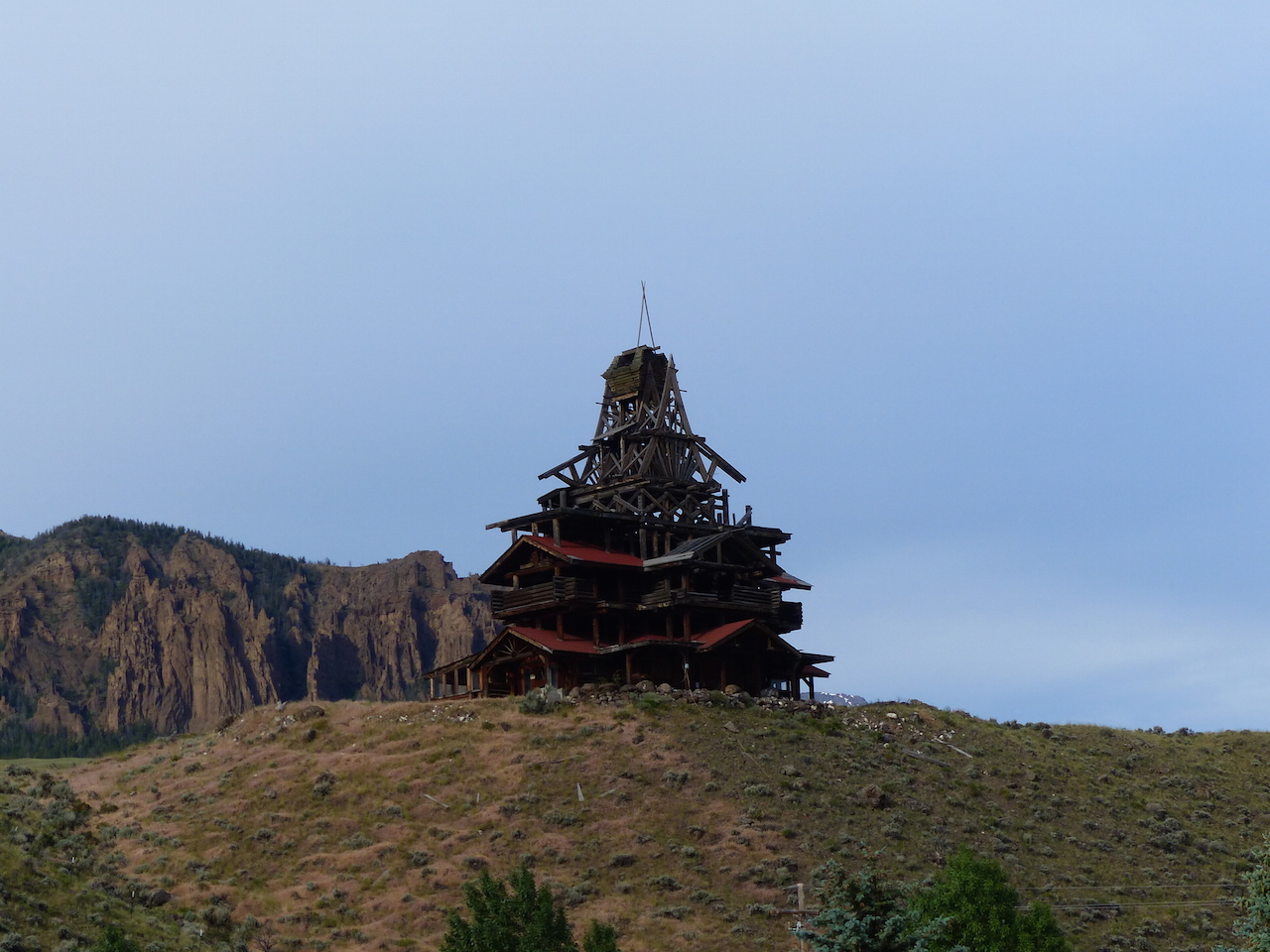
Our parting shot where we stopped for breakfast


Tuesday, June 21

We escaped! We were away at 6:30. Stopped at Madison to dump and take on water. Bought a few expensive groceries in West Yellowstone. Filled the gas tank with the priciest gas yet, $2.66 and took US287 to Beaver Creek campground. A delightful place. B loop is the best, but all spots there were reserved.

The traffic coming into The Park was a continuous line. A car was stopped in the east bound lane. Broken down? They were just sitting facing forward staring out. Traffic was backed up over a mile behind them. It was a small car they could have pushed it off the road. But…. We are done with Yellowstone. It’s has been destroyed by popularity. That's my last on The Park.

Funny thing 10 minutes north of West Yellowstone the scenery vastly improved. Topping most of Yellowstone. No traffic either.

We parked in a delightful USFS campground called Beaver Creek. It backs up to Earthquake Lake. There was a campground near here before 1959, when 7.5 earthquake caused a massive slide of earth from the mountain that buried the campground and killed 17. The earth slide dammed up the Madison River flowing from Yellowstone. The lake is seven miles long and filled with dead trees.

This quake started new geysers and changed old ones in The Park.


The hillside that fell during the quake damming the river

One of the cabins that floated around the new lake for a time.


The largest selection of dry flies I have ever seen. An equal number on the other side of the display. 

Make your own flies from chicken feathers. People breed chickens for the purpose if using their feathers for flies.

Pollen - It was dealing me fits before we left home two months back. As we have moved north, we have stayed with Spring. Each year it gets worse for me. I guess as the immune system deteriorates with age, the symptoms amp up. We saw a cloud of pollen suspended above pine trees last week. It must have been a quarter mile long and a hundred yards wide. Just hanging there. A wind gust soon brought it to us.

Wednesday, June 22

The drive up US287 to Eniss is through a valley along the Madison River. Large ranches and it’s supposed to be the best fishing in the state. We discussed all the animals we would want on a ranch there. The local feed store would do a brisk business with us.

We parked at Ruby Reservoir. OK place, but no cell and it looked like it could get real busy as the weekend started.

Ruby Reservoir

Beaver Head Rock. No we don't see a beaver.

Why I took a picture of Beaver Head Rock explained here

Thursday, June 23

On to Dillion for groceries and laundry. We parked just south of Dillion on Clark Canyon Reservoir. Good cell. We were experiencing withdrawal symptoms from the internet. The heat wave that has been in the area for the last 10 days is supposed to break tomorrow. Plan to stay here for the weekend and plan our route through Montana and Idaho. This has really been a wing it trip so far.

Friday, June 24

We slept until 8. Unusual for us. Got the yaks in the water by 10 and paddled around on the glass like lake for an hour. By noon, the predicted wind was up and the lake has white caps.


Clark Canyon Reservoir from our ramada

There is one other rig parked in the campground, but we have not seen any life forms around it. Two other rigs parked in another campground across the way. Again, no signs of life. However, local teen girls come in the afternoon in their bikini's.


Monday, June 20, 2016

From Cody To The Park


Warning Long Post

Monday, June 13 - Cody Wyoming

We came here to see the Buffalo Bill Center of the West. We passed on it the last time we were here. It gets rave reviews, but the things that the majority of folks enjoy, we tend to pan. So we did not approach it with high expectations. Pleased to say it exceeded our expectations. It’s not as good as some specialty museums we have been to, but it gives excellent treatment to a broad swath of topics. There are a lot of beaded clothes and knife and rifle holders. But, on inspection most were made in recent times. We spent two hours looking before our feet started to hurt. We will return in the morning to finish our tour.

We spent the rest of the day grocery shopping, getting propane, napping and touring the Buffalo Bill Dam. We chatted a long time at the dam with a local who has been going to Yellowstone for over 50 years.

Cody may be a tourist town, but we enjoyed our stay. The Albertson’s has a great selection of meat and salmon.

Cody also has colorful locals.


Tuesday, June 14

We spent the morning in the Buffalo Bill Center of the West. Most of the time we were in the firearms exhibit. It’s the largest in the world. They have acquired thousands of pieces from blunderbuss, wheel locks, flint locks and on up the evolution ladder. It helps that major collections, such as those held by the brothers who founded Remington, were given to the the museum. This year, they have an extensive exhibit from the Smithsonian. They have guns that have been presented to past presidents that have been loaned to the museum. Thomas Jefferson’s shotgun was very ornate.


Firearm control in Wyoming

Some of the items we found of interest in the firearms exhibit.

Paladin was a fav TV show of mine. I downloaded two episodes last year and found them boring. I guess you can not really go back.


Longmire - Buffalo is the setting for this series, but it is filmed in New Mexico. The museum got some of the props on loan. My favorite character is Lou Diamond Phillip, Henry Standing Bear. Dorothy, of course, likes Longmire. Tailored tight fitting blouses are popular on several law enforcement shows. Victoria Moretti takes it to the extreme with her blouse gapping open. I suppose to show her slutty side.


The museum has several weapons presented to US Presidents. Ike, JFK, Johnson, Reagan. We noticed there is no space to show one presented to Obama.


This is a strange one. A watermelon patch gun, possibly made in Montgomery, AL. You can read how it worked in the second picture.


Doesn’t everyone take pictures in the restroom? While I have never thought about putting my feet on the toilet seat, squatting is the way to go in asian countries.


And finally a mouse holding his breath in a bucket of water I left out overnight.


Wednesday June 15

We got away at 7:30 to go into Yellowstone or as the locals call it The Park. We had never entered from the east so now we have used all the entrances. US16 is quite scenic from Buffalo Bill SP to the park boundary. Some really strange rock formations - like the area around Fisher Towers.

We guess he got started and did not know when to quit building


There was a light drizzle as we climbed to 8,000 before descending to Yellowstone Lake. We went as far as the VC to kill time hoping the rain would stop and we would get a little more light. It worked and we got some decent shots of the falls from the north and south rims.


The roads were crowded. The parking lots were filled. Dorothy’s handicap plate came in handy. I asked a ranger if it was me or what because it seemed so crowded. He said they set an attendance record last year and were up 15% over that this year. I want to thank the park service for promoting the 100th anniversary of the park service. NOT!

Dozens of tour buses with Chinese characters on the side. The buffalo were out in force, but we were able to avoid the traffic jams by sheer luck. One of the wooly beasts was walking down the middle of the opposing lane and had traffic backed up for quite some ways. I ascribed thoughts to the bison, “Come on, just try to pass me and see what happens, Buddy”. I slowed down and got as far off the road as I could as we went by. I don’t want body damage by a bison.

We finished our Verizon month with a data surplus. Camping where there is no signal helps with that. We pigged out after dinner streaming shows until we were sleepy.

Thursday, June 16

We left Buffalo Bill State Park near Cody this morning and drove north on the Chief Joseph Scenic Byway - WY296. We drove it many years ago and we recalled as being scenic, but we were blown away this morning. It is one of the most spectacular drives in the country, especially south of Dead Indian Pass. It’s truly Big Sky Country. You want to know why its called Dead Indian Pass? Well, Chief Joseph had been running from the calvary for weeks. They thought if they could made it through this last pass, they would elude the calvary and certain death. They had to leave a wounded warrior at the pass and the calvary killed him. You will recall they did escape into Canada.

We are positioned to enter The Park Sunday morning and hope to get a parking spot at Indian Creek. We are also very close to the Bear Tooth Highway, which we will again drive Friday or Saturday.

We found a spot at Crazy Woman campground. It was OK, but no view and no amenities, but only $5 a night. We ate lunch and decided to look around at the other campgrounds in the area. We pulled into Fox Creek and it hit us that we had stayed there before. It’s all electric and only $10. It has a dump, but that was locked. It has water, but you have to use a water thief. The sites were filling up and we figured it would be crowded for the weekend. We headed back to Crazy Woman and noticed an ‘A’ Class parked in a meadow. Good place, but the wind was whipping up dust off the road. As we got to the black top I noticed a road right in front of us. It had the perfect spot for us right by the fast flowing Rock Creek. Just us, the mountains and the creek. It’s only 50 yards from the road, but the river drowns out what little road noise there is. If you want to park here, it’s 44.95916 - 109.81084.

We have spent 18 days in Wyoming so far. More than I would have guessed we would, but we do not have a plan or a schedule. Devil’s Tower 1 night, near Buffalo 3, in the Big Horns, Elgin Meadows 2, Silby Lake 1, Bald Mountain 1, Shell Creek 3, near Cody 4, and now here just east of The Park 3 nights.

Looming dread - We going to have to come up with a place to hide for the Fourth.

Friday, June 17

We went up the Bear Tooth Highway, Wyoming 212. We recalled it as being rocky and barren as most of it is above the tree line. And it was. Dark rock, patchy snow and deep green trees in the distance below. Also small lakes with rocky shorelines and deep blue water. It is a top-of-the-world drive at 10,050, but we prefer the lower section of Chief Joseph Highway.

In places the Bear Tooth Highway is quite narrow. Combine that with tight curves on a shelf road and it’s no place for RV’s. But, big rigs go up it every day. I am sure it’s fun when two RV’s meet on the tight curves.


Our Camp Site On The Rock River


What the Beer Tooth Highway is named for
Saturday, June 18

We drove in to The Park today. In the Lamar Valley, my ideal place to have a home. We all the way to Tower Junction where we chatted with a ranger for a long time. We went a mile south to Tower Falls to eat our picnic lunch and we got a text message. I checked the park map and saw that it showed cell phone coverage on a ridge just south of us. We found a pull-over with a shade tree and surfed for awhile. No one that had called us were available when we tried to return their calls.

Thinking we should call this trip the we can’t find it trip. Yesterday, it was my Jeep keys. We looked for 24 hours and they were almost exactly where they should have been. But before I found them, we lost Dorothy’s Jeep keys. I saw breaking windows to retrieve them from the locked Jeep. After searching off on on for several hours, Dorothy found them in the door lock right where I left them.

Sunday, June 19


We are The Park - More later.

Sunday, June 12, 2016

Our Week In The Big Horns

In Buffalo

Saturday, June 4

We toured the Jim Gatchell Museum, which tells the story of the town of Buffalo through the eyes and life of one of the founders. Had a marvelous lunch at Papa Bino’s and reprovisioned for our foray into the mountains. 

Our perfect and tranquil campsite went to hell when the local rednecks arrived in mass for the weekend. The one across from us was in a fifth wheel. He also had a Jet Ski on a trailer plus a cargo trailer. He came back today on a Harley. We guess he lives close by and takes all his stuff out and then takes it back.


 Six FEET in 4.5 hours!

Our Home In The Big Horns

The ascent up US16 from 4,500 to 8,000 was both quick and easy as we did not tow the Jeep. While there are several campgrounds in the area, there are more roads where you can park where ever you please. It pleased us to park here with this view out the Imax window. 

 
Close Up of the Big Horns From Our Parking Place

That’s new snow. The locals said they had a dry spring and it was only in the last month they got any rainfall. The pass west of us is 9,600 feet. There is ample snow in the fields above 9,000.

The pine forest remind me several alpine places, such as Grand Mesa, the Cascades, and Cedar Breaks. Deer graze in the meadow behind us.


The iPhone showed no service even with the booster on. However the mifi could got two bars with the booster. But, we could only use it the mornings. Why? Not a clue.

Monday, June 6

We drove Rubi west on US16 into Tensleep Canyon. We passed this way before and I wanted to see if it was like I recalled it. It was not. I had some other canyon with sheer rock walls in mind. We continued on to Paint Rock Canyon and found Utah in Wyoming.


Utah In Wyoming

I wanted to hike the canyon a little ways. But it was already 86 when we got there at 10:30. I could feel the heat reflecting up from the pink sand. I am not into torture. It was 59 when we returned to the pass. 5,000 feet makes a difference in temperature

I made a wrong turn and it took us a few miles out of the way. No big deal. But it did cause me to miss the back road up the mountain. While on the wrong road, named 43 1/2, six RV’s passed us going the opposite direction. Six RV’s on a back back road! And two of them were Cruise America. There too many people out here, nothing is remote now. We stopped at a small VC for local Indian rock art way the heck back up a dead end road. I looked at the Vistor’s Register and there were entries from all over.

Why Tensleep? Indians counted a journey by the number of nights it took. Tensleep is half between two Indian settlements now named Casper and Bridger.

We found this former Class A on the road. It caught fire last night.


A Former RV That Caught Fire Near The Top Of The Grade Of Ten Sleep Canyon


Western Horses Are Better Looking Than Their Southern Cousins


Tuesday, June 7

Moving day. We have seen all we wanted to see on US16, so we went back down to Buffalo, north to Sheridan and up US14. The ascent on this road is quite scenic. We parked at Sibley Lake, about 8,800 feet. It looks good for paddling, but signs warn us we need an inspection decal to launch. A guy inspected us last week, but did not give us a decal. And so it goes.

This side of the Big Horns is not so impressive. There is only one necklace of peaks and we were much closer to them on the south side.

Lunch was rather exciting. I shook up the 57 and twisted the top open. 57 went on me, shorts, shirt, the dashboard, etc. Dorothy did not take a clue from me, when she opened the catsup, but since it was pointed down, she did not get a full bath in it. First time atmospheric pressure has zapped us.

No cell coverage here. May go into detox.

Wednesday, June 8

We went west on the infamous US14A. We stopped short of the decent at the Bald Mountain campground. It’s not officially open yet, so we parked for free. The elevation is getting to Dorothy. She spent most of the day resting.

We drove down the mountain in the Jeep. The road surface was fine, the lanes were wide and the curves were not bad. However, it’s 10% for 10 long miles. Not a road for a motor home unless you want to have the rotors replaced. I had the Jeep in first gear, that kept us to 25mph, a little slow, but fine for looking. To descend in the RV, it would mean using first gear which would spin the engine up 5,000rpm for the full ten miles. We will use the slightly less steep US14 to get down. It’s only a 7% grade.

In the afternoon, I went out seeking to bag a water fall. First I went to Porcupine Falls and saw the trail went about straight down. No thanks. There was a gentleman at the trailhead on an ATV. Turned out he owned a nearby lodge and was out with his grandson. He told me that there was a overlook for Bucking Mule Falls only a mile from the trailhead. This falls has a 570 foot straight drop. The picture at the trailhead was inspiring. I wanted it. The sign at the trailhead said two miles. OK, he said the trail was more or less level so I will try it. I went 50 minutes down the trail just over the creek and was starting up the other side when I realized I was bushed. I was already going to get back later than I told Dorothy I would. It was a great hike though a beautiful forest. I enjoyed it. Tho I am disappointed I could not get to the waterfalls.

Bucking Mule Falls - Not My Picture

Dorothy was feeling better when I got back. That was a good thing.

Thursday, June 9

Dear Readers, I am sure there are damn few of you that have read this far. And I don’t blame you. The blog is primarily for us to read when we can no longer travel. Hoping that does not happen, but reality often trumps hopes.

We got away early and drove back east to an overlook which has a view of the basin below. Three bars make up to the overlook. We had breakfast, showered, and surfed for two hours. 

Sadly the haze over the basin continued today and was supplemented by rain in the mountains to the west. So no pictures. But what a view it would be on a clear day.

We needed to get to a lower elevation so Dorothy can breath. If elevation can pop the tops off plastic oil bottles, it can surely affect the body.

We went south on US16 to Shell Canyon which is almost two thousand feet lower at around 7,600. We got the only non-reservable site and plan to stay the weekend. The heat wave is supposed to pass Sunday. We don’t want to deal with heat. Her systolic dropped 15 points with the decrease in elevation and continued to drop another 15 in the afternoon. 

All the sites here are close to a river that is roaring with snow melt. We can take our chairs down the river’s edge and sit in the shade.

We are right on the border of the Cloud Peak Wilderness. We will not hike any of the long trails, but we will drive the perimeter road looking for a special photo op.

No cell signal here, otherwise it would be prefect for us.

In the afternoon we took Rubi on what turned out to be  some high clearance 4WD drive roads. Our destination was Woodchuck Pass where we hoped to get good view of the southern Big Horns. We forded two streams, the second was about the limit of Rubi. When we got to a third stream, Willits,  it was roaring. I waded in till I was knee deep and could see it was deeper ahead. So like yesterday we did not get to our destination. Still, except for the boulder fields on the road it was a fun trip in the mountains.

We got back just in time for a wind storm and rain. I would love to see how the kids from Lehigh U are doing making camp in the group area. Gee, it must be fun. They were all smiles when they went past.

The brief storm cancelled our plans to slurp a bottle of fine Deming, NM wine by the river. It dropped the temp 25 degrees to 50.

In the news we heard about the idiot who went off trail at Yellowstone and was dissolved in the acidic spring. The last time we were at Yellowstone, we were on a ranger lead walk at the same springs. Her hat blew off and landed about 30 yards from the boardwalk. She was after her hat in a flash. She explained she could not afford a $100 replacement.

Friday, June 10

We tried another FS road, but only got about a mile before we encountered a locked gate. The Forest is just not open yet. This is the third day we have not gotten to our destination. 

We headed down US 14 to Shell Canyon. The Shell River runs behind our campsite and has carved a huge canyon on it’s way to the basin. One of the attractions is Shell Falls, which the FS has spent big bucks making walkways to the falls and along the gorge. We sat at the falls for a time. Most came and went in less than a minute. 


 Shell Creek Falls. The Same Water That Flowed Past Our Camp Site

We continued downhill to the basin into 95 degree heat and drove five miles down Red Gulch road. It looks a lot like Utah with the iron oxide stained rocks.


Just because we were there, we stopped at what the BLM calls one of it’s gems - dinosaur foot prints. They say there are over 1,100 of them in an area about the size of ballroom. I took a picture. One may be a dinosaur footprint.


 One Of These May Be A Dinosaur Foot Print


More Utah Color In Wyoming


Reminds Me Of Mexican Hat, Utah


Saturday, June 11

We tried another FS looking for scenery. Did not find much of note. We were back near 9,000 and Dorothy was feeling the pain. I decided rather than retrace out steps at altitude, we would descend the mountain, eat in Sheridan and then come back up on the paved road. It was the long way around for sure.
One of the dozens of streams in the Big Horns. Several have falls, but you need to be a moose to get to them this time of year due to run off

Dorothy thought this looked like fingers. There several Japanese looking rock gardens


Yeah we saw some moose

Sunday, June 12

We moved west to Cody to do some tourist things and some mundane things like laundry, grocery shopping and picking up our mail