Tuesday, May 30, 2017

The Alabama Hills - One More Time


Tuesday, May 23
We thoroughly enjoyed the unseasonably cool weather the last 10 days. The cool temps allowed us to stop at Valley of Fire. We are paying for it now. We got away from the brake repair shop in LV about 1 pm and made it Amargosa Valley, where the temp reads at the century mark. There is a nice roadside rest area and we thought we could run the generator for a few hours and stay cool. The generator started normally and ran for a few minutes and quit. I tried it again with the same results. It has always worked flawlessly. Turned out the air filter was clogged up. Can’t imagine how? Grin

Anyway, we wimped out and went next door where they have hookups. The AC has been running non-stop for over two hours and we are in partial shade. 

Wednesday, May 24
From Amargosa Valley through Death Valley to Lone Pine. The single destination that Dorothy wanted to do this year. It’s always more magnificent than we recall it.

                                             *  *  *

Dear Diary, This should be of interest to only you and me. In case I ever have to do this drive again. Here’s what I should expect.

Leave Beatty at 3,500 and immediately ascend to 4,300. Then it’s downhill for 13 miles to a narrow section of Death Valley at 157 feet. This is where we unhooked the Jeep.

Then a long gradual climb to Townes Peak at 4,977. Then 9 miles down to Panamint Valley at 1,168. [Noted gas was $4.48 at Panamint Springs] Now you go up to 4,800 feet in the Saline Valley. Yes, this valley is up from the last one. The twisty road slowly climbs to 5,200 before you descend to Owens Valley at 3,700 feet. 

Summary:
Slight up 800 feet
Then down from 4,300 feet to sea level
Up to Townes Peak to 4,977
Down to Panamint Valley at 1,168
Up to Saline Valley at 4,800 - 5,200
Down to Owens Valley at 3,700

More concisely:
Three ups totally 9,800 and three downs totally 10,700 in little more than 100 miles.                 

                                           *  *  *

We are parked 800 feet higher than Lone Pine in the Alabama Hills. The temp was warm, but a breeze made it quite manageable. 

Gas in Lone Pine is 3.65, a buck and a dime more than in Nevada.

Thursday, May 25
We were up at 5 for the morning light show on the Sierra Nevada, which started at 5:15. We needed long sleeves for an hour. We have been coming here since 2002 and the place is now well known. We could see five other RV’s parked in the distance when we went outside. All are parked in locations where they have privacy, but no view of the Sierra Nevada.

The Morning Light Show


 Our Parking Spot

 Cotton Like Plant


For nostalgia, we drove to the Mt. Whitney Portal. Only five miles from our parking spot, it’s another world. The stunning walls of granite rising straight up. The waterfalls splashing down with the snow melt. The air temperature 30 degrees cooler. The Hills look like slag piles in the distance.

I think our last significant hike was to Lone Pine Lake several years ago. We very much enjoyed it. Dorothy’s stressed her feet on the way down and they have not been the same since.

Friday, May 26
We had breakfast at the Alabama Hills Cafe. They serve way too much food, which is the reason we like it. Dorothy had the Humphrey Bogart Skillet and I had the Clint Eastwood. The former has bacon, the latter sirloin strip with eggs and potatoes.


We took another nostalgia drive today up Horseshoe Meadows. It features sweeping views of the Owens Valley and a side-long look at the majestic Sierra Nevada.

We spent the afternoon reading. The thermometer read 80 degrees, but we got cool and had to put on long pants and shirts. 

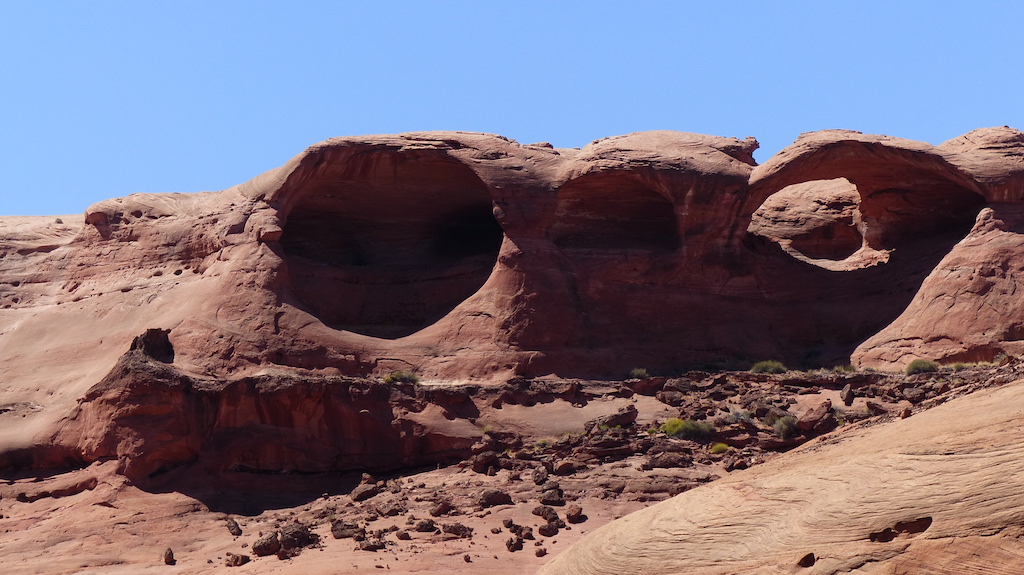
Our parking spot is near the famous arch. Today, we saw two couples walking with their maps in hand looking for the arch. We told them they had passed it. In fairness, you have to be alert to find it and not take any shortcuts.

Our neighbor is a free climber. He makes it look so easy.

Saturday, May 27
It’s is such a treat to wake and see the light show on the mountains. This is one of the best parking spots we know. [This is our sixth time here. 2004, 2006, 2008, 2010, 2015 and 2017] Dorothy wants a home exactly where we are parked. I suggest we obtain on the BLM signs “Closed for Restoration” to put on the trail to enhance our privacy.

Dorothy got an upset stomach after coffee, took a long nap but recovered by 11 to prep Chicken Piccata.

Sunday, May 28
Our last day in The Hills. Lots of people touring the roads, lots camping in our “private space.” They were no bother. Would stay longer, but it’s hot.


The JUICY rental vans are quite popular. We just can not imagine that anyone with any self-respect would rent one.


Monday, May 29
We went an hour north to Bishop. The place was hopping. Our fav restaurant was closed. We got groceries and filled the gas tanks at the Indian Res. Only $3 a gallon. We parked at Horton Creek because they have a dump and water and we needed that. Still too hot. Headed north in the morning.

Tuesday, May 30
We went up Sherwin Grade unhooked. It’s only a 2,500-foot elevation gain, but it takes 10 miles to do it. I had forgotten how great the Sierra’s are in this section. We parked at Convict Lake, which is pretty busy. Fishing season just opened here.

Only 82 here in the afternoon. Much better.

At least someone remembers us. Our granddaughter used our car last week. When she pulled into her driveway, our grand dog went bonkers when she saw the car. You see that car sometimes brings her ham bones and other good things. When our grandkids see us drive up, it’s not the same, more of an “Oh you are here”.

Tuesday, May 23, 2017

Return To The Valley Of Fire In Nevada

Tuesday, May 16
I had forgotten the splendor of east Zion. We drove through in the early morning and I wanted to stop and look, but that can not be done in MH. We continued on promising to return and stay at one of the private CG’s on that side of the park so we could enjoy the morning sun in that area. 

We perched on one the mesa’s east of Hurricane for the evening. We watched several showers on the features of Zion. Little moisture reached us. But, every few hours we heard a few drops on the roof.

Wednesday, May 17
We spent the morning shopping at Walmart, Costco and Harbor Freight in Washington.  We proceeded west a few miles and stopped at a delightful BLM CG in the Virgin River Gorge. I think it rivals the gorge the Colorado carved on I70. Many of the spots are pull through and the cost is $4.


Dorothy got this one while we were transiting Zion

 Roadside BLM Campground in Virgin River Gorge

Thursday, May 18
We decided on a whim to spend the weekend at the Valley Of Fire SP, which is near Los Vegas. We did not get OUR site, it was taken by a rental. In fact, most of the sites are taken by rentals as we are so close to Vegas.

I was planning to leave around 3 and find a place to photograph. However, around 2 the blue skies disappeared behind 100% gray clouds and a brisk wind. So we spent some of our free time removing some of the accumulated pink dust from both vehicles.

The big surprise is the temperature. At 4 pm, it’s 68.

Friday, May 19
Not a cloud in the sky. We got out at 7 for early light. We saw no one else, except for the rentals illegally parked on the roadside. We say ban rentals. Even better ban all foreigners from vacationing in the USA. Dorothy read that 85,000 Europeans enter the USA every day. That’s over 300 plane loads. OK, they can come, but we should charge a stiff entry fee. They dress funny. They clutter the place up. They pretty much ignore the rules and do as they please and feign ignorance when caught. 

Saturday, May 20
A month or so back, I thought we would have been to Lone Pine and headed north. The weather there was perfect. Then I got a wake-up call. Thanks, MJ! North of Bishop is 3,000 feet higher, around 8,000 feet. Which means it will always be colder. All of the western mountains got snow recently. Now it’s much warmer in Lone Pine and the northern Sierra Nevada is defrosting. Time to go. 

We lucked out with the cold front we have enjoyed the last week. It was not cold for us, it just made the lower elevations tolerable for this time of year. It’s over. High today is 87. Tomorrow is 93 -  more seasonable. Time for our exit. Tomorrow we will seek relief in the mountains west of Vegas. Then we will make our final drive to Lone Pine through Death Valley. We don’t care much for DV, but it’s the shortest route. I can’t recall if we have to summit two or three ranges before the final ascent to Lone Pine. There are more named ranges in Nevada than any other state. And a few of them extend into California.

We will “hole-up” in Lone Pine for the holiday weekend.

We closed out our stay here taking more photographs in the late afternoon. I concentrated on places I did not go two years ago.

 Valley Of Fire

  Valley Of Fire

  Valley Of Fire

  Valley Of Fire - All The Colors

  Valley Of Fire

 Valley Of Fire - Looks Like A Shrine

 A Mini Slot In Valley Of Fire - The Effect Is Called Alpenglow I Am Informed


Sunday, May 21
We stopped and did four loads of laundry while crossing North Las Vegas. Our destination was Mt. Charleston which is just west of the city. It’s Nevada’s highest. Many others in the city thought it was a great day to escape the heat and hike or picnic in the cooler mountains as the traffic up the grade was always backed up behind slow us. There are a dozen hiking trails in the area. They looked punishing to me, as they go about straight up. There is a lodge with a jammed packed parking lot and hundreds of homes, mostly new, in the million dollar price range. It seemed that about a third of them are for sale.

Monday, May 22
We made ourselves lazy, cleaned the windows and did not much else. When I sat down outside to read I noticed a puddle under the passenger rear wheel. I checked and found it was brake fluid. Nothing to do but go back to Las Vegas and get it repaired. 

Tuesday, May 23. We left the campground at 6:10 and got to the repair shop at 7:20. It was already rush hour traffic in LV. The caliper was leaking. I had them all replaced last year. So much for PM. They say it will be ready about noon. So we will go somewhere north this afternoon. Tune in next week to find out where. It will be in the high 90’s everywhere in the area.


Tuesday, May 16, 2017

Rocks and Water

Rocks and Water
Sand in your throat
Baby, do I feel gritty


I had a rhyme with throat, but forget it

On our last day at Lone Rock, we rented a 22 foot Cobalt. It did not come with the extra crew shown in the stock picture, but we made do. The high freeboard made the ride completely dry when the wind picked up and the waves were confused. We got too much sun, but we thoroughly enjoyed the day. We have been traveling for 11 years, but for some reason, this has been my second most enjoyable trip so far.


Dusk On A Cloudy Day - The Dinner Cruise Boat


The Rainbow Lasted Almost An Hour

The Full Moon Following the Rainbow 

Rocks And Water - Cruising on Lake Powell


Antelope Canyon

Tour Boat In Antelope Canyon

One Of The Thousand Houseboats. I Like The Name
Yes, You Will Go and You Will Have Fun Or Else

 Gunsight Bay


 Navajo Arch
What You Can Not See Are The Two Shelves In The Left Cave. Ideal Shelter


Headed Home

What We Found At The Dock
An Ambulance, Flashing Lights and A Dozen Park Police

The Park Police were having drills. One drill was a bad guy pushing a Ranger overboard. The Ranger lands on his back and draws his weapon.


Paria Canyon

Notice the gray hoodoo in the left foreground and the yellow in the background


Friday, May 12
We left Lone Rock and traveled 9.5 miles west to the Vermillion Cliffs. We had planned to tent camp one night at a remote site called White Pockets. We were there last year and wanted to take pictures at both sunrise and sunset there. It takes three hours to drive to the trailhead, so overnighting is the only option to avoid driving in the dark. However, the winds remain strong and sleeping in a tent in a wind storm is not all that much fun. We did that last year. 

We came here anyway and have taken some 2WD trails we have not been on before. Long Canyon was not scenic. While the road continued long past the place the maps and GPS showed it ending, it never got close to any good scenery. It skirts the wilderness and you sure don’t want any non-hikers to peek into the wilderness. No, that is reserved only for the physically able, most of whom wear REI apparel so they can be recognized as one of the clan.

We are ground zero for strenuous long distance hiking and the place is about empty today. Good for us. I talked with three tired young hikers, who had come here from Lee’s Ferry. That’s about 40 miles through some most unforgiving terrain, including cold water to your waist and quicksand. 
Most use the trailhead to hike to Buckskin Gulch. A few to The Wave.

We opened a bottle of wine that tastes like a cross between a sherry and Amaretto.


Our Parking Place

 What Came With Our Parking Place

Dorothy Was Not Pleased With Our Friend

Saturday, May 13
We drove to the place that was once a small town in the late 1800’s and then it was a western movie set. Floods took out both the town and the movie set. The end scenes of The Outlaw Josey Wales were filmed there. It was the last movie filmed there. Vandals burned the reconstructed set. Fantastic scenery, but I did not score a good picture there. 


After lunch and nap, we did the short hike to the Rimrock Hoodoos. Been meaning to go here for years. It was worth the short hike.

Sunday, May 14
We set out to see more hoodoos. We got four miles down the road to find a sign that said the road was no longer authorized to access the hoodoos. We went to another adjacent section where we found the gates had been replaced by fences. It may be BLM land, but Dorothy says it’s owned by REI shoppers. We pick on REI since they support making public lands into wilderness areas. It’s good for their business.

We returned to the camping area for lunch and found we are the only ones here. Perhaps because of Mother’s Day?

A treat here this year is cell phone service. Last year we could get one bar in only one inconvenient location on the side of the road. This year, we get three bars with the cell amp. 

It’s so great to get out the gravel pits of NM and AZ and into red rock country. We will trade pink dust for endless gray gravel any day.

Our daughter called this morning to extend Mother’s Day greetings. She asked Dorothy what we were doing today. Dorothy said Looking at rocks. Alecia asked What else? Dorothy said Looking at more rocks. Our daughter tires of rocks pretty quickly.

We took our last drive this afternoon up Kitchen Wash. Beautiful country. The only people we saw were cowboys branding calves. We got to the official geographic location for both the White and Vermillion Cliffs.


Utah Greens Up After A Shower


Dorothy Calls This Her Fav Volcano

Most of the wonders of southern Utah are in a circle. Roads run around, but none through the circle. I was reminded of this when we got to the end of the road at 6,200 feet and could see Bryce Canyon in the distance. 

We finished the third season of Bosch.

Monday, April 15
We want to see both Red Canyon and Red Cave. Both are a little north of Kanab. There are not many places to boondock here, for motorhomes anyway. Plenty of un-level places for trailers. Serendipity happens.  A friend is in the area and told us where she would be parking with the WINS group. So we are with them. No cell service on this side of the mountain.

The clouds increased in the afternoon and the temperature dropped. I checked the forecast and saw clouds, some rain and below 40 temps were forecast the rest of the week. To photograph slot canyons you need mid-day sun and dry roads. There was a light rain late in the day. Perhaps enough to make dirt road travel impossible. Lacking the requisites, we will head west Tuesday. Lone Pine awaits us. It will be 90 there, but in the 70's north of Bishop. You can't have it both ways.

Wednesday, May 10, 2017

On The Strip

The strip refers to northern AZ and southern Utah

 The Blue Bird Of Happiness?

Thursday, May 4
Dorothy made scrambled eggs and chocolate milk for breakie. The eggs had a dark appearance. I asked her what she put in them. She said “Onions.” I said “And what else, dirt?” She started laughing and continued laughing. Finally she said “I messed up and put chocolate in the eggs.”

We took the 27 mile loop from Sunset Crater NM to Wapatki AZ. The former is a huge lava field. It’s not unlike Craters Of The Moon in Idaho or Newberry in Oregon. We thought it was more photogenic than the former, but did not take a single picture. Geesh it’s lava. Enough for a zillion BBQ grills for a gazillion years.

We found Wapatki most interesting. Several pueblo Indian ruins. They were intact when the Mormons passed through as they did drawings of them. The Hopi built them, left them and the Navajo took up residence until the Blue Coats ran them off. During prohibition moonshiners were using them and tore down many of the walls down to combine rooms. The sheriff could not root out the moonshiners so the Feds were invited to make it a monument and enforce the laws. The feds were particularly nasty in running off the remaining Indians who had been given permission to live there until their death.


 Wapatki AZ.

What a difference a hour can make. We woke up in a quiet pine forest and parked just after lunch on the beach at Lake Powell. Tahoe is a splendid scenic lake, but we favor Powell. Totally different scenery this afternoon. Goodbye green things. Hello red rocks.

 The Beach At Lone Rock On Lake Powell

 Lone Rock


Friday, May 5
It appeared to us that Lake Powell was up considerably. We Googled and saw that it has been rising every year the last four years. Rocks ledges across from us where we beached the boats a few years ago are so far under water we could not see them - and the water is clear. We paddled into a canyon that has always been dry and plan to return and go farther. 

We noticed that Page seems to have more Indians. Small wonder, since one of the largest reservations in the country borders on the town. The younger ones are easy to spot, they are wearing hoodies in 90 degree temps.

Saturday, April 6
High winds today, gusts to 39, cancelled paddling plans. In the morning we checked out renting a runabout to sightsee the lake and take pictures. The rentals at the marinas are twice the rate for the ones not on the lake. Government concession limits competition. We were OK with the rate, but the Jeep is only rated to tow 2,000 pounds and the boat weighs 3,000. And so it goes. We found another place that also rents a truck to tow the boat, so we are good to go.

We drove a short way on a dirt road and thought we were in Moab. Then we saw a wide paved road with a sign that said only Amangiri. A paved side road in these parts is unheard of, so we turned in and drove a mile or so through rock formations that looked like the Courthouse cluster at Arches. We finally get to a key coded gate with another sign that says only Amangiri. There was also a wind sock and we decided the wide paved road was also an airstrip. We asked a local about it and found it was a resort for swell folks that can afford $1,500 plus a day.
https://www.aman.com/resorts/amangiri 

In afternoon, we went to a car show in town put on by the locals. There were two cars we had never heard of, some classic’s, a few rat rods, etc. We finished our town trip with some of the Best Margaritas In Town. They were only so-so.

Sunday, April 7
The wind is lower, but still kicking up some sand on the beach. Not so much so on the perch above the beach. We turned on the generator so we could vacuum the pink dirt. That took an hour of our morning. The wind had blown one of our kayaks in the water and another kayaker had chased it down for us. We are now known as the people with the boats. Since the wind was still too much for paddling, we did laundry.

Monday, April 8
There was a shower overnight. Probably only lasted a few minutes, but we woke up and saw water on the Jeep. First time we have seen rain reach the ground in southern Utah. The temp dropped to 48.

We paddled the yaks in the morning and read all afternoon.

Tuesday, April 9
It was overcast and the wind was calm when we woke up, per the forecast for today and Wednesday. By 10, the sun was out and a delightful breeze came up. Life was good. We were sitting outside enjoying the weather when the breeze piped up a little and Dorothy suggested we stow the awing. We did. A few minutes later she served stuffed pork chops and we felt the rig shake. I saw a sand storm out the back window. In seconds we were coated, again, with pink sand. We were fortunate that the back end of the KoKo was into the wind, escaping sand coming directly through the windows. An ample plenty came in the sides. We battened down the hatches.  Have to tell you, we had little after taste of the pork chops, just sand in our mouths. We spent 90 minutes vacuuming up the pink stuff. Twice in a week is enough. The temp dropped 20 degrees.

After two sand storms in a week, it makes it easier to understand how the rocks have been eroded. 

Wednesday, April 10
Overcast in the morning and a moderate breeze. We went to town for groceries. Tomorrow is supposed to be good weather for our boat ride. The forecast for the next ten days after that is more wind. That will cancel our planned overnight tent trip into the wilderness. We have digested enough pink sand.

Even with not so great weather we have enjoyed eight days here.


 Her Pick

My Pick

Up A Canyon

 Dorothy Coming To Shore

 The Not So Good, Pink Sand

More Pink Sand


The next edition will be about our boat trip on the lake.