Sunday, March 22, 2015

The Arizona Strip – III

Pictures taken at our camp site, White Rock CG. We would call it Chocolate Swirl CG.

11a White House06 11a White House10One Of My Fav’s11a White House11

Yellow Mountain

This has been on my bucket list for years. The first time I tried it, I could not even find the trail from the road through the Tamarisks. This time I was able to find the faint trail, mostly used by cows. After crossing the shallow Paria River and entering the drainage canyon, I found the trail. Can you see it? Steep and filled with scree. It was the challenging climbs I have attempted. Huffing and puffing, I thought twice about blowing it off. After resting for awhile and looking up, I was twice enticed to continue and twice fooled by false tops.

11e Yellow Mountain01 Somehow, I made it and this was the view. I would have liked to hiked over to it and walked around on it. But I was totally baked. So I contented myself shooting hand held with 600mm digital telephoto.11e Yellow Mountain05 11e Yellow Mountain19 11e Yellow Mountain23

Looks like a wave to me 11e Yellow Mountain24 

Jaded

After the sights we have seen in the last month, we are now jaded. Nothing else, in the US, compares to Valley of Fire or the pockets of wonder found in and around Vermillion Cliffs. This is nirvana for us. Several years ago, I bought two books on photographing the south west. They have pointed us in directions we would have never known about. He provides details on the best time of day for photography and detailed access information. The day we were leaving Vermillion Cliffs I thought to look at them. Discovered I had left plenty on the table. I hope to live another year so can return and at least try to get some of the shots he did.

Indian Country

When you drive east from Page, AZ you enter Indian Country. Most of AZ, NM and southern UT is Indian Country. We elected to take this route to Moab simply to stay in the boonies. On a whim, we decided to see what the Navajo Monument was all about. Well, it’s like Mesa Verde, without all the people. The only person in the VC was a Indian woman running the book store. She was most forthcoming in answering our questions about Indian culture. The campground is delightful. We were the only ones here all afternoon. After 6, two tenters showed up. And it’s free.

The more remote Keet Seel site is accessed from here in the warmer months. It’s supposed to be the best preserved site in the SW. We will not be seeing it as it is a 17 mile hike.

You decide from the pictures, if it’s worth your time.

12 Navajo Monument01 Any and every canyon out here has ruins

12 Navajo Monument02 12 Navajo Monument04

Thursday, March 19, 2015

The Arizona Strip - II

You have probably heard of The Wave in the North Coyote Buttes section of the Vermillion Cliffs NM. It’s a very popular destination on the Utah/Arizona border. To be able to hike to it, you have to enter a lottery. In high season, the chances of winning are about nil. There is no sense in us entering the lottery, because of the seven mile round turn hike plus the time you need to wander around once you get there is way over our physical limits.

There are other sections of Vermillion Cliffs that are just as mystical, but are not as popular, since high clearance 4WD is required to get to them. That’s one reason why we bought a Jeep so we could drive close to these places.

The first one we visited is called White Pockets. It took us 1:45 minutes to drive the 36 miles to it. The last 10 miles is through fairly high sand. One other couple was there with us. Sweet! It was another all day affair, but worth it we think.

White Pockets – Vermillion Cliffs NM

11White Pocket07 11White Pocket11 11White Pocket12 11White Pocket14 11White Pocket16b

Tuesday – March 17 – Off at dawn to Pah Hole and Cottonwoods. Left at 7, back at 2:30. Another long drive and tiring day.

Pah Hole – South Coyote Buttes – Vermillion Cliffs NM

Paw Hole is all about oranges. It is not a large area by any means. Dorothy and I both agreed that White Pockets is superior to Pah Hole.

 11c Pah Hole05 11c Pah Hole15 11c Pah Hole16

Cottonwood – South Coyote Buttes – Vermillion Cliffs NM

Cottonwood is a mix of oranges, whites and pastels spread over several square miles. With binoculars you can just make out The Wave from here. Dorothy likes Cottonwood over White Pockets. I like it second best of the three areas.

11d Cottonwood01Teepee Formations 11d Cottonwood07 11d Cottonwood14aDorothy’s Pineapple 11d Cottonwood15Uplifted, Twisted, Tilted and Eroded11d Cottonwood16Darn Strange Rock Formation 11d Cottonwood17The Celebrated Wave Is In The Background

Monday, March 16, 2015

The Arizona Strip - I

First, Wrapping Up The Valley Of Fire

09Valley of Fire045How the early Indians illustrated hydrocarbon bonds 

09Valley of Fire049

The deep orange colors catch fire in low angle lighting

09Valley of Fire051

 The pastels also deepen in color in low angle lighting

09Valley of Fire056

It only looks like a swift flowing river

Thursday, March 12  -  We left St. George after spending two days of provisioning. We shopped at Costco and Walmart, then did laundry and got an oil change for Koko.  We discovered that this week is Spring Break for Nevada and Utah.  It's wonderful that people take their children camping.  But since we don't have small children any longer, we try to find places to hide!

Instant heart failure - After spending $350 on food, that night I noted the refrigerator was not on. If it had failed, we would be out the food and marooned until the refrigerator guts could be replaced. I cut it off and back on. It started normally and has given no problem since then. Fingers crossed.

Time Marches Over Us - We left Pacific Standard Time one day, got hit with Daylight Savings the next, then Mountain Time a few days after that. Now in Arizona we are on Mountain Time, without DS, unless you are on an Indian reservation where they observe DS. Got that? All I know is that it was dawn at 6 in California, now it’s 7:30 until there is some light out.

Milestones – We have spent 1,400 nights in Koko since September, 2007. She turned 80,000 miles last week.

Pipe Springs

As we were driving towards Kanab, we saw the sign to Pipe Spring National Monument.  I thought there would be nothing there and in 10 minutes, we would be back on the road.  I just love it when we come across wonderful unexpected surprises.  This was one of them.  We had a Ranger led talk.  Pipe Springs had been home to the Kaibab Paiute Indians for hundreds of years until the white man showed up.  The Mormans built a fort over the spring for their convenience, which cut off water to the deer and the Indians.  The cattle ate the grasses which were a food source for both the animals and the Indians. There was no fighting with the Paiute, but the Navajo were a different problem as they were raiding both whites and Paiute’s.  The fort, Windsor Castle, is a marvel.  The home is on one side and across the enclosed courtyard was the spring, which was used to make butter and cheese.  This was taken by wagon to St. George, which is one hour's drive today, but was four days by wagon.  All of the food, including cattle, was to feed the men building the temple at St. George.  This trip was made twice a month.

In the Visitor's Center, we met a young ranger and he told us about two viewpoints of the GC that he liked that are way the hell down dirt roads on the north rim. We bought a huge BLM map and Don spent several hours mapping out these places.

Toroweap – This has been on my bucket list for over a decade. 63 miles down a gravel road to an overlook of the GC. Unlike at the North and South Rims, this overlook goes straight down 3,000 feet. No ledges. I managed to get within two feet of the edge, but had to jump back as all sort of sensations were going in my chest. You can see Lava Falls from here. It’s supposed to be the worst of the rapids. But at over a half a mile away, the rapids look look riffles.

It was a LONG day and we were tired puppies when we got home.

10Toroweap04cI found a place where I was comfortable taking pictures. I saw one woman on the edge. She was squatting taking pictures. The toes of one foot were over the edge. 10Toroweap11

Wednesday, March 11, 2015

The Valley Of Fire - TD

We are traveling from one fantastic place to another. We left The Eastside and crossed the Inyo mountains and down to the Saline Valley on CA168 eventually finding our way to US95 on the west side of Nevada. We did not see another car the last 23 miles. After four hours of mountain driving, we over-nighted in a rest area along the highway north of Las Vegas.

Going through Indian Springs the next morning there was a demonstration at a military base. This is where drones are piloted through-out the world. Several hundred rag-head sympathizers were assembled to protest killing innocents. They were well matched by at least 100 police, some mounted.

Our destination was the Valley of Fire State Park which is about 50 miles north east of  Las Vegas. It’s our first time here. This place has some fantastically colored and oddly eroded rocks. A wonderland of geology. It’s a little like Capital Reef, but with it’s own flavor. Even in March, the weather is delightfully warm.

Arriving at a state park on the weekend is looking for trouble, but we were in time to snag a prime space. We found a parking place that is U-shaped. High rock walls on three sides. Prefect privacy.

The first morning we hiked White Dome. The next morning, Fire Trail. We were by ourselves both days.

09Valley of Fire006Along the highway 

09Valley of Fire007 Along the highway 

09Valley of Fire008 Along the highway – Rainbow Vista

09Valley of Fire013

09Valley of Fire021 White Dome Trail

09Valley of Fire026 White Dome Trail

09Valley of Fire036

Fire Trail 

09Valley of Fire041

Fire Trail

Tuesday, March 3, 2015

Still On The Eastside

Friday – February 27 - We happily remain in The Hills. A place where most people spend an hour or two, we tarry. Not a soul has come up our road spur in a week. I half expected we would have another camper here today when we returned.

After taking more sunrise pictures, we were off to a place that has been on our bucket list for some years. Since this is a public blog, I will not mention the name as it’s private and sadly not well protected from the teaming masses. [If we know each other and you want to know, write me] It is the premier mining ghost town. Family squabbles prevent it from being put to it’s best use or protecting it for the future. Anywho, we were pleased to tour it and listen as the only resident regaled us with the history of the place.

We enjoyed Deadwood when it aired. We bought all three season to watch while we are off-the-grid. The Elizabethan-Victorian dialog and the sometimes Greek drama devices amuse us. David Milch is a treasure. Anywho, as Robert was talking about the shootings, whores, and saloons in the mining camp of 2,000 souls, it was easy to think of the similarities to Deadwood. He said that gunfire was so frequent, miners would sandbag their beds to prevent being killed while asleep.

07cerro gordo04Dorothy with Robert who is the sole and chief engineer, fixer-upper and bottle washer 07cerro gordo09 07cerro gordo12

07cerro gordo02Looking west at the Sierra Nevada. After three clear days, some water vapor returned07cerro gordo19Looking east, Saline Valley, Panamint Valley, Death Valley and into Nevada. 

07cerro gordo20 Perhaps the only picture you will see of a Joshua Tree in the mountains.


Scroll down for part II

Still On The Eastside - II

Continued from part I

06ah027Another sunrise in The Hills 

06ah041

06ah048

Morning Exercise

06ah049

Wall Flowers

06ah053

Sweet Home

06ah059

Rock Art

06ah064 

This shot is not juiced. It is just as the ‘P’ setting saw the low sun.

We have enjoyed five very rare clear days here. No water vapor. I thought it was over at cocktails yesterday when I saw a big ole jetairoliner coming out of LA streaming a long contrail. Weather report confirmed a storm coming down from Oregon bringing snow and low temps for several days. Happily, the added water in the air did not materially obscure our views.

The storm cancels my plans to hike to a glacier lake that is not too far from the road as that road will be covered in 8 to 12 inches of snow. Most of the eastside lakes are too far and too high for me to make an attempt and I really wanted to make this one. And so it goes.

Of the many things I like about The Hills is the easy walking. Take off in any direction and meander around the interesting rocks. The surface is mostly clear, so keeping balance is easy.

OUCH! Gas prices have gone up 70 cents in a week here. We were so happy to come out of Death Valley and see $2.69. A week later the sign reads $3.39.

One or more Navy squadrons must be qualifying for deployment as they have been doing flight ops for over a week. We were on a back road the other day and by onezies and twozies they flew us by on the deck. Only one attacked us. After he finished his strafing run from behind, he put his wings vertical and flew by us. If I was a pilot I would know what that position is called. I really envy the fun they can have.

I am becoming convinced that my medical episode last week was altitude related. We had been at over 4,000 feet for three days, down to sea level, then to 5,000. I was not real perky at 4,000 and woke up at 5,000 feeling totally beat. After another week at 4,000 I have finally acclimated and feel great. Today, at the ghost town at 8,000 feet, I had little energy to walk more than 20 yards at time. Neither of us have ever acclimated to elevations over 7,000, even tho those are the places that most attract us. Getting old sucks.

Reading back over these rambling words, I must beg your indulgence at the common need for an old man to talk of himself.

Saturday – February 28 – The storm clouds passed through last night and it was another clear day. We considered going north this morning if our drugs arrived. We remain as the post office here is closed on Saturday. First thing today, we did the Arch loop walk. One spur to the trail starts feet from our parking spot, but we have gone in all other directions. Then into to town on some errands. After lunch and nap, I wanted to try again to locate the narrow canyon we “discovered” on our first trip here. There are so many trails here, you can be close but miss what you are seeking. After an hour of driving and hiking we finally found the place. The sun was way too low for pictures, so we hope Sunday will be another picture perfect day.

A BLM ranger stopped by and we enjoyed a log chat. He clued us about a hidden canyon with scarlet flowers. We recalled meeting him on a previous trip. He obviously likes his job. He has been here for nine years, the first two as a volunteer.

P1020968

Pink Clouds This Morning

P1020974

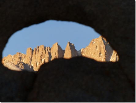
The Ever Popular Arch That Frames Mt. Whitney

P1020978

The Love Rock?

P1020981

Along The Trail

Sunday – March 1 – We heard what we took for rain for a minute or so around 8pm last night. We woke to see The Hills dusted with snow this morning. For a brief time, the sun peaked through the heavy clouds and then suddenly the clouds descended to the deck. We are pleased to have brought winter to the area. It was 33 at 6am. By 8:30, the snow was almost gone. The clouds remained and the mountains were submerged all day.

Monday – March 2 – We packed up and went into Lone Pine to pick up our drugs at the Post Office. Turned out our daughter never mailed them. And so it goes. We were out of food and needed to dump the black tank at 11 days, so we drove north to Bishop, the closest grocery store and dump. We decided to park at the fairgrounds, no scenery, but full hookups. Electricity will be nice with the coming cold air.

We got here a week or so late or a week or so early. Right in the middle of the only winter storm.  Chains are required to get over the pass to Eureka Dunes. Looks like that will stay on the bucket list. Bradford Pear and Lilac are in full bloom. Guess they don’t know winter is yet to arrive.

We decided to stay Tuesday and maybe Wednesday then we will regretfully turn south again and cross the mountains through Death Valley.

Worked on taxes today. Maybe they are done. My record keeping is so sloppy the last few years, the IRS sends me notices that I forgot this or that income.